
REMOTE SENSING
 ___
___ 
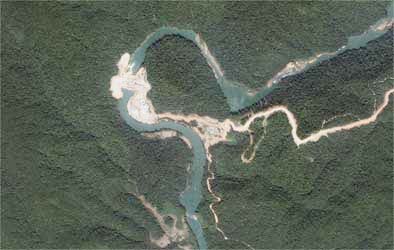
GeoCapacity provides satellite images of the highest quality resolution from the GeoEye-1, WorldView-2, WorldView-1, QuickBirdand IKONOS satellite imaging sensors. Experienced in negotiating custom satellite images within both satellite and client-governed timelines, we work with image data from many United States and foreign operated satellites to procure the desired satellite image and data needed by your industry.
These services include:
» Satellite Imagery & Digital Aerial Photography
High and Medium Resolution Imaging
High Resolution Digital Photography
» Orthorectification
» Raster-to-Vector Translation
» Land Cover and Change Detection
For city planning, pipeline routing, or law enforcement, our geodetic and mapping experts create two-dimensional interactive mapping projects by overlaying third-party data, such as land cadastre ownership information, census data, and labels of geographic features.